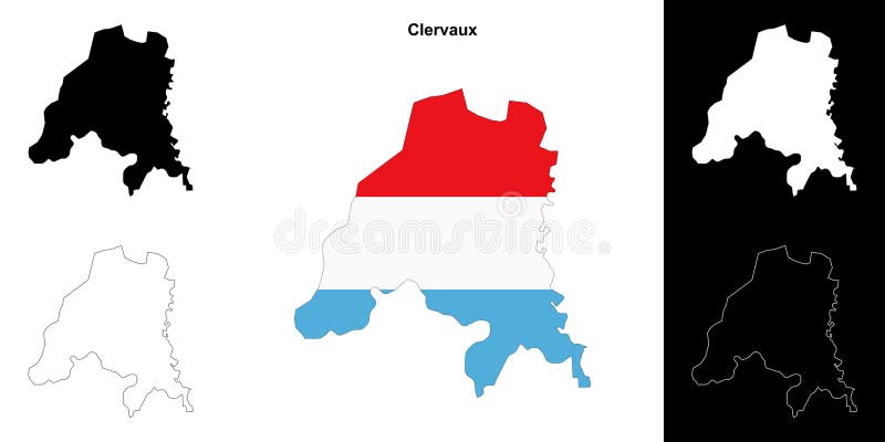
Gratis med prøveperiode Clervaux outline map clervaux canton outline map set stockillustration clervaux outline map clervaux canton outline map set
Gratis med prøveperiode Silhuetter af Luxembourgs regioner og et blankt kort over landet isoleret på hvid baggrund. Vektordesign royalty-free illustration Silhuetter af Luxembourgs regioner og et blankt kort over landet isoleret på hvid baggrund. Vektordesign
Gratis med prøveperiode Expert artistry of depiction of clervaux clervaux luxembourg clervaux clervaux luxembourg generative ai stockillustration. expert artistry of ai generated depiction of clervaux clervaux luxembourg clervaux clervaux luxembourg generative ai. expert artistry of depiction of clervaux clervaux luxembourg clervaux clervaux luxembourg generative ai stockillustration
Gratis med prøveperiode Canton clervaux luxembourg solid capital of color shape corner auxiliary location maps royalty-free illustration canton clervaux luxembourg solid capital of color shape corner auxiliary location maps
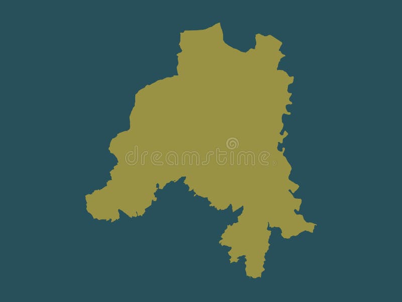
Gratis med prøveperiode Canton clervaux luxembourg solid no legend of color shape stockillustration canton clervaux luxembourg solid no legend of color shape
Gratis med prøveperiode Clervaux canton grand duchy of luxembourg administrative divisions map vector illustration scribble sketch royalty-free illustration clervaux canton grand duchy of luxembourg administrative divisions map vector illustration scribble sketch
Gratis med prøveperiode Canton clervaux outlined luxembourg physical administrative area of on a colored elevation map stockillustration canton clervaux outlined luxembourg physical administrative area of on a colored elevation map
Gratis med prøveperiode Canton clervaux outlined luxembourg grayscale administrative area of on a elevation map stockillustration canton clervaux outlined luxembourg grayscale administrative area of on a elevation map
Gratis med prøveperiode Vintage map of luxembourg with cantons on retro paper background vectorillustration vintage map of luxembourg with cantons on retro paper background
Gratis med prøveperiode Canton clervaux highlighted luxembourg grayscale administrative area of and outlined on a darkened elevation map royalty-free illustration canton clervaux highlighted luxembourg grayscale administrative area of and outlined on a darkened elevation map
Gratis med prøveperiode Canton clervaux canton of luxembourg low resolution satellite map corner auxiliary location maps canton clervaux luxembourg low stockillustration canton clervaux canton of luxembourg low resolution satellite map corner auxiliary location maps canton clervaux luxembourg low
Gratis med prøveperiode Clervaux outlined luxembourg physical administrative area of on a colored elevation map vectorillustration clervaux outlined luxembourg physical administrative area of on a colored elevation map
Gratis med prøveperiode Canton clervaux luxembourg high res satellite capital of resolution map corner auxiliary location maps stockillustration canton clervaux luxembourg high res satellite capital of resolution map corner auxiliary location maps
Gratis med prøveperiode Canton clervaux luxembourg described location diagram of showing the region on larger scale maps composition vector frames and png royalty-free illustration canton clervaux luxembourg described location diagram of showing the region on larger scale maps composition vector frames and png
Gratis med prøveperiode Clervaux outlined luxembourg grayscale administrative area of on a elevation map vectorillustration clervaux outlined luxembourg grayscale administrative area of on a elevation map
Gratis med prøveperiode Canton clervaux luxembourg low res satellite no legend of resolution map vectorillustration canton clervaux luxembourg low res satellite no legend of resolution map
Gratis med prøveperiode Canton clervaux luxembourg high res satellite no legend of resolution map stockillustration canton clervaux luxembourg high res satellite no legend of resolution map
Gratis med prøveperiode Canton clervaux luxembourg isolated on white physical administrative area of a colored elevation map vectorillustration canton clervaux luxembourg isolated on white physical administrative area of a colored elevation map
Gratis med prøveperiode Clervaux highlighted luxembourg physical administrative area of and outlined on a darkened colored elevation map royalty-free illustration clervaux highlighted luxembourg physical administrative area of and outlined on a darkened colored elevation map
Gratis med prøveperiode Canton clervaux luxembourg isolated on white grayscale administrative area of a elevation map royalty-free illustration canton clervaux luxembourg isolated on white grayscale administrative area of a elevation map
Gratis med prøveperiode Clervaux highlighted luxembourg grayscale administrative area of and outlined on a darkened elevation map royalty-free illustration clervaux highlighted luxembourg grayscale administrative area of and outlined on a darkened elevation map
Gratis med prøveperiode Canton clervaux luxembourg low res satellite major cities canton clervaux canton of luxembourg low resolution satellite map vectorillustration canton clervaux luxembourg low res satellite major cities canton clervaux canton of luxembourg low resolution satellite map
Gratis med prøveperiode Canton clervaux luxembourg solid labelled points of cities color shape locations and names major the region corner auxiliary royalty-free illustration canton clervaux luxembourg solid labelled points of cities color shape locations and names major the region corner auxiliary
Gratis med prøveperiode Canton clervaux luxembourg high res satellite major cities of resolution map locations the region corner auxiliary location maps royalty-free illustration canton clervaux luxembourg high res satellite major cities of resolution map locations the region corner auxiliary location maps
Gratis med prøveperiode Canton clervaux luxembourg low res satellite labelled points of resolution map locations and names major cities the region corner stockillustration canton clervaux luxembourg low res satellite labelled points of resolution map locations and names major cities the region corner
Gratis med prøveperiode Canton clervaux luxembourg high res satellite labelled points of resolution map locations and names major cities the region corner vectorillustration canton clervaux luxembourg high res satellite labelled points of resolution map locations and names major cities the region corner
Gratis med prøveperiode Clervaux luxembourg isolated on white physical administrative area of a colored elevation map stockillustration clervaux luxembourg isolated on white physical administrative area of a colored elevation map
Gratis med prøveperiode Clervaux luxembourg isolated on white grayscale administrative area of a elevation map royalty-free illustration clervaux luxembourg isolated on white grayscale administrative area of a elevation map
Gratis med prøveperiode Canton clervaux outlined luxembourg topographic humanitarian administrative area of on a style map stockillustration canton clervaux outlined luxembourg topographic humanitarian administrative area of on a style map
Gratis med prøveperiode Canton clervaux highlighted luxembourg topographic humanitarian administrative area of and outlined on a darkened style map stockillustration canton clervaux highlighted luxembourg topographic humanitarian administrative area of and outlined on a darkened style map
Gratis med prøveperiode Clervaux outlined luxembourg topographic humanitarian administrative area of on a style map stockillustration clervaux outlined luxembourg topographic humanitarian administrative area of on a style map
Gratis med prøveperiode Clervaux highlighted luxembourg topographic humanitarian administrative area of and outlined on a darkened style map royalty-free illustration clervaux highlighted luxembourg topographic humanitarian administrative area of and outlined on a darkened style map
Gratis med prøveperiode Canton clervaux luxembourg isolated on white topographic humanitarian administrative area of a style map stockillustration canton clervaux luxembourg isolated on white topographic humanitarian administrative area of a style map
Gratis med prøveperiode Clervaux luxembourg isolated on white topographic humanitarian administrative area of a style map vectorillustration clervaux luxembourg isolated on white topographic humanitarian administrative area of a style map
Gratis med prøveperiode Clervaux luxembourg topographic humanitarian administrative area of on a style map royalty-free illustration clervaux luxembourg topographic humanitarian administrative area of on a style map
Gratis med prøveperiode Canton clervaux luxembourg topographic humanitarian administrative area of on a style map stockillustration canton clervaux luxembourg topographic humanitarian administrative area of on a style map
Gratis med prøveperiode Clervaux canton grand duchy of luxembourg administrative divisions map vector illustration scribble sketch vectorillustration clervaux canton grand duchy of luxembourg administrative divisions map vector illustration scribble sketch
Gratis med prøveperiode Clervaux canton grand duchy of luxembourg administrative divisions map vector illustration scribble sketch clervaux map clervaux royalty-free illustration clervaux canton grand duchy of luxembourg administrative divisions map vector illustration scribble sketch clervaux map clervaux
Gratis med prøveperiode Vector regional map of luxembourg with cantons and administrative divisions editable clearly labeled layers vectorillustration vector regional map of luxembourg with cantons and administrative divisions editable clearly labeled layers
Gratis med prøveperiode Vector regional map of luxembourg with cantons and administrative divisions editable clearly labeled layers vectorillustration vector regional map of luxembourg with cantons and administrative divisions editable clearly labeled layers
Gratis med prøveperiode Vector illustrated regional blank map of luxembourg with cantons and administrative divisions neighbouring countries territories vectorillustration vector illustrated regional blank map of luxembourg with cantons and administrative divisions neighbouring countries territories
Gratis med prøveperiode Vector regional blank map of luxembourg with cantons and administrative divisions neighbouring countries territories editable vectorillustration vector regional blank map of luxembourg with cantons and administrative divisions neighbouring countries territories editable
Gratis med prøveperiode Vector regional blank map of luxembourg with cantons and administrative divisions editable clearly labeled layers stockillustration vector regional blank map of luxembourg with cantons and administrative divisions editable clearly labeled layers
Gratis med prøveperiode Vector regional blank map of luxembourg with cantons and administrative divisions editable clearly labeled layers stockillustration vector regional blank map of luxembourg with cantons and administrative divisions editable clearly labeled layers
Gratis med prøveperiode Vector illustrated regional map of luxembourg with cantons and administrative divisions neighbouring countries territories royalty-free illustration vector illustrated regional map of luxembourg with cantons and administrative divisions neighbouring countries territories
Gratis med prøveperiode Vector regional map of luxembourg with cantons and administrative divisions neighbouring countries territories editable clearly vectorillustration vector regional map of luxembourg with cantons and administrative divisions neighbouring countries territories editable clearly
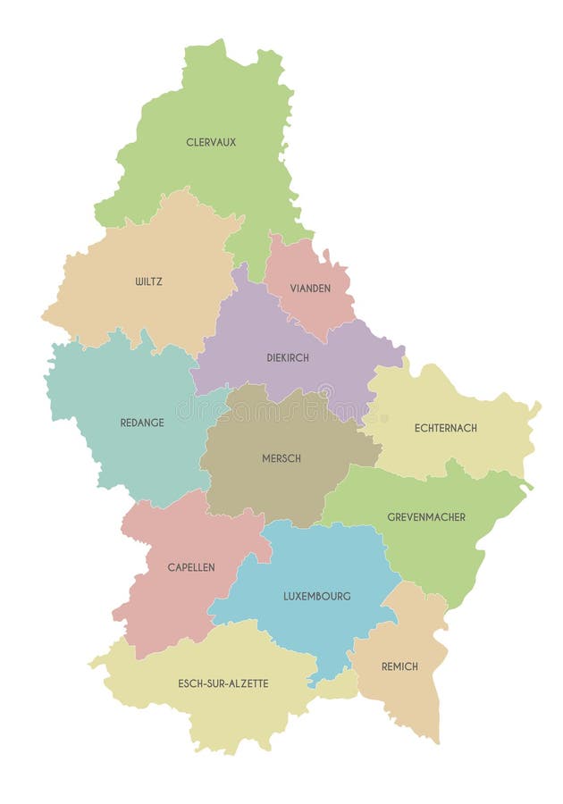
Gratis med prøveperiode Luxembourg - kort over kantoner royalty-free illustration Luxembourg - kort over kantoner
Gratis med prøveperiode Location map of redange canton black location map of luxembourgian canton of redange within grey map of luxembourg stockillustration location map of redange canton black location map of luxembourgian canton of redange within grey map of luxembourg
Gratis med prøveperiode Black location map of luxembourgian canton of vianden within grey map of luxembourg location map of vianden canton royalty-free illustration black location map of luxembourgian canton of vianden within grey map of luxembourg location map of vianden canton
Gratis med prøveperiode Black location map of luxembourgian canton of luxembourg within grey map of luxembourg location map of luxembourg canton vectorillustration black location map of luxembourgian canton of luxembourg within grey map of luxembourg location map of luxembourg canton
Gratis med prøveperiode Luxembourg higt detailed map with subdivisions administrative map of luxembourg with districts and cities name colored by states royalty-free illustration luxembourg higt detailed map with subdivisions administrative map of luxembourg with districts and cities name colored by states
Gratis med prøveperiode Cantons of luxembourg map of regional country administrative divisions colorful vector illustration cantons of luxembourg map of royalty-free illustration cantons of luxembourg map of regional country administrative divisions colorful vector illustration cantons of luxembourg map of
Gratis med prøveperiode Cantons of luxembourg map of regional country administrative divisions colorful vector illustration luxembourg administrative map royalty-free illustration cantons of luxembourg map of regional country administrative divisions colorful vector illustration luxembourg administrative map
Gratis med prøveperiode Cantons of luxembourg map of regional country administrative divisions colorful vector illustration luxembourg administrative map stockillustration cantons of luxembourg map of regional country administrative divisions colorful vector illustration luxembourg administrative map
Gratis med prøveperiode Cantons of luxembourg map of regional country administrative divisions colorful vector illustration luxembourg administrative map vectorillustration cantons of luxembourg map of regional country administrative divisions colorful vector illustration luxembourg administrative map
Gratis med prøveperiode Black location map of luxembourgian canton of wiltz within grey map of luxembourg location map of wiltz canton royalty-free illustration black location map of luxembourgian canton of wiltz within grey map of luxembourg location map of wiltz canton
Gratis med prøveperiode Cantons of luxembourg map of regional country administrative divisions colorful vector illustration cantons of luxembourg map of royalty-free illustration cantons of luxembourg map of regional country administrative divisions colorful vector illustration cantons of luxembourg map of
Gratis med prøveperiode Location map of mersch canton black luxembourgian within grey luxembourg royalty-free illustration location map of mersch canton black luxembourgian within grey luxembourg
Gratis med prøveperiode Black location map of luxembourgian canton of remich within grey map of luxembourg location map of remich canton stockillustration black location map of luxembourgian canton of remich within grey map of luxembourg location map of remich canton
Gratis med prøveperiode Black location map of luxembourgian canton of capellen within grey map of luxembourg location map of capellen canton vectorillustration black location map of luxembourgian canton of capellen within grey map of luxembourg location map of capellen canton
Gratis med prøveperiode Wincrange outlined luxembourg physical administrative area of on a colored elevation map stockillustration wincrange outlined luxembourg physical administrative area of on a colored elevation map
Gratis med prøveperiode Wincrange outlined luxembourg grayscale administrative area of on a elevation map royalty-free illustration wincrange outlined luxembourg grayscale administrative area of on a elevation map
Gratis med prøveperiode Canton wiltz outlined luxembourg physical administrative area of on a colored elevation map royalty-free illustration canton wiltz outlined luxembourg physical administrative area of on a colored elevation map
Gratis med prøveperiode Wincrange highlighted luxembourg physical administrative area of and outlined on a darkened colored elevation map vectorillustration wincrange highlighted luxembourg physical administrative area of and outlined on a darkened colored elevation map
Gratis med prøveperiode Canton wiltz outlined luxembourg grayscale administrative area of on a elevation map royalty-free illustration canton wiltz outlined luxembourg grayscale administrative area of on a elevation map
Gratis med prøveperiode Wincrange highlighted luxembourg grayscale administrative area of and outlined on a darkened elevation map royalty-free illustration wincrange highlighted luxembourg grayscale administrative area of and outlined on a darkened elevation map
Gratis med prøveperiode Canton wiltz highlighted luxembourg physical administrative area of and outlined on a darkened colored elevation map vectorillustration canton wiltz highlighted luxembourg physical administrative area of and outlined on a darkened colored elevation map
Gratis med prøveperiode Canton wiltz highlighted luxembourg grayscale administrative area of and outlined on a darkened elevation map royalty-free illustration canton wiltz highlighted luxembourg grayscale administrative area of and outlined on a darkened elevation map
Gratis med prøveperiode Wincrange luxembourg isolated on white physical administrative area of a colored elevation map vectorillustration wincrange luxembourg isolated on white physical administrative area of a colored elevation map
Gratis med prøveperiode Wincrange luxembourg isolated on white grayscale administrative area of a elevation map stockillustration wincrange luxembourg isolated on white grayscale administrative area of a elevation map
Gratis med prøveperiode Canton wiltz luxembourg isolated on white physical administrative area of a colored elevation map stockillustration canton wiltz luxembourg isolated on white physical administrative area of a colored elevation map
Gratis med prøveperiode Canton wiltz luxembourg isolated on white grayscale administrative area of a elevation map royalty-free illustration canton wiltz luxembourg isolated on white grayscale administrative area of a elevation map
Gratis med prøveperiode Wincrange outlined luxembourg topographic humanitarian administrative area of on a style map stockillustration wincrange outlined luxembourg topographic humanitarian administrative area of on a style map
Gratis med prøveperiode Wincrange highlighted luxembourg topographic humanitarian administrative area of and outlined on a darkened style map vectorillustration wincrange highlighted luxembourg topographic humanitarian administrative area of and outlined on a darkened style map
Gratis med prøveperiode Canton wiltz outlined luxembourg topographic humanitarian administrative area of on a style map royalty-free illustration canton wiltz outlined luxembourg topographic humanitarian administrative area of on a style map
Gratis med prøveperiode Canton wiltz highlighted luxembourg topographic humanitarian administrative area of and outlined on a darkened style map stockillustration canton wiltz highlighted luxembourg topographic humanitarian administrative area of and outlined on a darkened style map